Leaving Oxford on the Bicester train leave the train at Islip station walking out of the train station and turn left onto the Blecthingdon road continue your walk into the delightful village of Islip. Islip is a beautiful, well preserved village standing near the confluence of the rivers Ray and Cherwell. There are many pleasing buildings, notably the Old Rectory, built in 1690 by the Rector Dr South, who also founded and endowed the village school in 1710. Look out for the sixteenth century Manor Farm house in Upper South Street. Take time out to find a house in High Street built in the seventh century formerly the King?s Head Inn. Islip at on time lay on the coach route from London and Worcester and could boast twenty-one inns. thetradtion that Islip at one time could boast twenty one inn is now more than a myth but myth reflects that facts, In reality inns came and went in the 17th and18th centuries much the largestinnwastePrince of wales or Plume of feathers, on thesite ofthe old coal yard opposite thered lion with 18 rooms it was like an hotel and could accommodate gentry in comfort.
Its gentelemen innkeepers were rich. It declined in the later 18th Century and was demolished by 1812. The older inns were essentially alehouses and with limited accommodation and catered mainly for carriers.The King\’s Head is attested as early as 1607 but closed in the middle of the 18th Century. The Worcester Arms and Red Lion was closed about 1725. The existing Red Lion open some time later and took the place of the Feathers as Islp’s leading Inn Othe rinns operated in the early 18th Century The Fox and grapes closed in 1928 The Hare close 1770 and the White swan stil ltrades. In the 19th Century The Boot in Mill Street closed in1890,and the saddlers Arms in middle Street closed in 1969 Both the Bowling Green and the Bell were 19th Century beerhouse since close and there location unknown Now there are only two.
The Red Lion, and. The Swan Inn. While refreshing yourself in one of these perhaps a pint of local ale and a ploughmen’s lunch. You may like to contemplate the ancient fame of Islip and its place in English history. Islip has a long history with evidence of human occupation in the area since the Stone Age. Not far from where you are sat. Once stood the Palace of Ethelred the unready, where in 1004AD King Edward the Confessor was born. When King Edward built Westminster Abbey he gave to it the manor of Islip. The Royal link has led to a long involvement within the parish with Westminster Abbey which owned land here for many centuries and is still patron. Islip provided two great ecclesiastics in the middle ages. One Simon of Islip became Archbishop of Canterbury in 1348. And John of Islip became Prior of Westminster in 1500 and thus presided over the building of the Henry VII chapel.

Islip Church
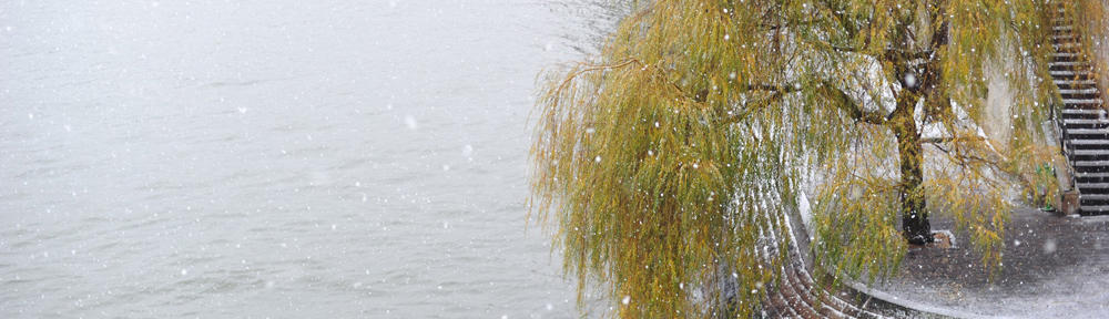
As befits a village with such a history, Islip Church dominates the village. Its beautiful three-story tower was built in the fifteenth century. There is almost as much history, at the southern end of the village the river ray, a tributary of the Cherwell was forded here and this is indicated in the origins of the place name which incorporates the Old English name “Ight” and a word meaning a place where things were dragged “Slaep”. During the civil war Islip was an important outpost in the Royalist defence of their headquarters at Oxford. In 1645 Cromwell defeated the Royalist forces in a skirmish at Islip Bridge. The present stone bridge with its four arches was built in 1878. Before then until 1788 a turnpike was set up which closed the road through the ford. The earlier bridge was only used when the ford was impassable. Flowing west from Otmoor the river was a valuable fishery until it was deepened in the nineteenth century following the Otmoor Drainage Act. A local industry produced osier cages or wheels for eel catching. Islip was a prime source for fish supplies beside course fish, eels, and crayfish were plentiful wildfowl were to be had in season and osier reeds were cut from the river banks
Islip to Noke 1 miles
“I went to Noke and nobody spoke”
Leaving Islip cross the bridge taking time to watch the River Ray flowing under the bridge before it slowly meanders on it way through the dreaming spires of Oxford. Take care as you walk along the Wheatley road B4027 heading south continue along the road. In the hedgerow grow three closely related plants which have very different growth forms. Nettles in the base of the hedge can be easily identified; elm has very rough leaves while tendrils of the hop twine round any thing they touch. The hop shoots are sensitive to contact and bend in the direction of the touching side. So end up growing round a support. All of these plants can be seen later along the walk.
Continue up a steep hill, until you come to an allotment entrance on the left. When a gate is reached on your left take the concrete track leading through the allotments for 10m, then take a stony track bearing off to the right. Follow this and continue over several stiles along the footpath through arable fields to Noke. As you walk through these arable fields, notice how there is few or no flowering plants compared to the hedge bottoms and field edges. Herbicide sprays are used to eliminate weeds which would compete with the crop for water, light and space as well as harbouring pests and diseases. Insecticides are used to control aphid infection of crops which would cause a reduction in yield. Aphids suck the sap from the plants and can transmit virus diseases, thus are a serious pest of cereal crops.
Along this path there are wide views over the fields and Otmoor. These fields have an interesting past. In Roman times there was a villa and field system here and many centuries later this was Islip\’s Cow pasture. Probably equivalent to the huge pasture recorded in the Doomsday book of 1066. Even the path is old. Those villagers in Noke who paid tithes to Islip\’s parish church buried there dead in Islip churchyard and to this day the path is known as the “wake” or “coffin path.” Looking to the left, variations in the field and hedge pattern can be seen. The hedges crossed by the path are relatively recent, probably planted in the early nineteenth century when Islip open fields were enclosed. The hedge in the distance towards the river marks the line of the Parish boundary between Noke and Islip and is much old than the hawthorn enclosure hedges. The hedges are useful refuges for birds and in autumn for yellowhammers. andflocks of finches can be seen and heard searching for food.
At the end of the arable field climb the stile and walk down a grassy track lined with trees and shrubs on each side. The hedge on the left is part of the parish boundary. Look at the mixture of species contained in it and you will see there are far more variety than in the hedges seen earlier. Look out for a type of hawthorn with rounded rather than dissected glossy leaves. This is midland or woodland hawthorn and its presence indicates that this hedge is likely to date from a time when this immediate area was woodland.
Notice the increase in numbers of plant species once the intensively cultivated fields are left behind. The succession of flowers in spring greater stitchwort cow parsley and ground ivy, followed by white dead nettle, red clover, hogweed, field bindweed and black knapweed all provide food for numerous bees, flies, and other insects. Continue through the tunnel of hawthorn and blackthorn to the road and turn left a few yards down the road in to Noke.
On your left is The Plough Inn which was originally a cottage dating back to the seventeenth century. There is plenty of time to call into the inn to sample one of the land lord\’s fine local ales. The name Noke means “at the oak trees.” Noke dates from late Anglo-Saxon times then it would have been a clearing in extensive woodland, remnants of which will be seen later. In the sixteenth century members of Oxford University would seek refuge in Noke in order to escape the ravages of the plague.
Leaving the plough inn continue walking into the Village of Noke on your left is The Manor Farm this is a fine building with stone work dating from the late sixteenth to the eighteenth centuries, and near by the old Rectory has a central block dating from the seventeenth century with eighteenth and nineteenth century extensions with these extensions. It is note worthy that the Rectory is now considerably larger than the church itself. Look out for the steeply pitched roof of one of the old Rectory barns this Barn roof was original thatched the sharp angle of the roof helping the rapid drainage of water

Noke Church
St Giles church Noke is tiny, dating from the early thirteenth century and restored in 1883. When Edward the Confessor granted the fees of Islip to the Abbey of Westminster part of the parish of Noke was included in the grant. Those who paid there tithes to Islip buried there dead in Islip church yard. Among the intriguing stories about Noke is one relating to Benedict Winchcombe, a huntsman who died in 1632 and whose tomb is at St Giles’s It is said that on wintry nights he and his hunt still gallop through the village if any one is brave enough to listen out for them.
Near the church still stands the former Noke Voluntary School opened in 1863. In 1906 Conditions at the school were, as in many schools basic the medical inspector of 1908 reported that there was no lavatory and water was carried in from the school house. Yet education records for the early years of the century 1904 were good, including such observations as the mistress deserves great praise for her training of the children in neatness and regular attendance. The school closed in the early 1970’s.
Noke to Beckley 2 Miles
“I went to Beckley, they spoke directly”
Follow the lane through the village of Noke to Lower Farm lookout for the Bridle way on your right. On an old map of Oxfordshire dated 1797 Lower Farm was called New Farm. As only in a few preceding years had a large part of Noke wood been cleared and enclosed for agricultural land. The bridleway follows the edge of a large prairie style field. This huge field at one time would have composed of several small fields. The wet nature of the low-lying Otmoor can be seen in the water filled ditched Bright greenflote grass grows in this ditch along side the field as well as broader-leaved canary grass with the extra colour in summer from the pink flowers of great willow herb and dark red figwort. Hogweed grows in profusion here and its large flower heads are very attractive to the large number of bright coloured flies, bugs, bees and beetles. Spiders and aphids are frequent residents amongst the hollow, ridged stems supporting the flower heads.
Follow the wide, mown grassy path. That has been left at the edge of this large arable field and thanks to the care taken by the farmer in spraying operations; many flowers can still be seen here. In spring time. Primroses bugle, greater stitchwort, violets, celandine and many more other flowers scatter the verge and banks of the large ditch along side. The coppice visible through the hedge would in the past have been cut in a regular cycle depending on the size of wood needed for poles and fencing. Regroweth occurs from the base of the tree, the stool, and provides a long-term renewable supply of materials. With the hedge on your right (western side), gradually rising south easterly for about half a mile. On reaching the remains of a triangular copes the bridleway crosses in to Noke Parish and continues to the edge of Noke wood.
Continue walking along the southern boundary for 500 yards, and follow the foot path through Noke Wood. Noke wood was once a part of the Royal Forest of Shotover during the reign of Henry II in the twelfth century. Today this is a good example of a hazel coppice. In spring many flowers along the path indicate the antiquity of this woodland yellow archangel, wood anemone, dog?s mercury and bluebells. In the wood look out for obvious well-trodden animal paths about eight inches wide, used by deer and foxes. Birds which can be heard include the chiff-chaff calling its name, also wrens, blackcaps, robins and great tits. The woods fall silent during the summer.
Walking out of Noke wood follow the narrow path through scrub on the edge of a rough field This field at one time was used as common land it is marked by tussocks of hard rush, a tough plant not eaten much by sheep and cattle you can see it growing in many grassed fields along this walk. This is an indication of poor drainage. The grass in this corner has not been improved too much with fertiliser. Greater burnet, with unusual dark red, yellow vecthling, and a variety of other flowers grow here. The large patch of yellow daisy-like flowers is flea bane, an aromatic plant which was collected by villagers dried and played in bedding to ward of fleas.
Follow the path up the hill pausing from time to time to enjoy the view across Otmoor. This group of fields were once part of Beckley common, an open area distinct from common land of Otmoor which would have been used for rough grazing and for gathering fuel the fields were formed at the time of the Parliamentary Enclosure of Beckley in 1827. A regular feature of grazed fields is the number of characteristic plants protected from cattle, horses or sheep. Nettles and thistles hurt the soft mouth and docks taste bitter. Creeping thistle and spear thistle are eaten by many insects, the damaged patches and webbing on leaves and the swollen lumps on parts of some stems are signs of this. The flowers are very attractive to bees and butterflies as well as to the bright reddy-orange uniformed soldier beetles.
Upon reaching the top of the field spend some time enjoying the panoramic view of Otmoor a scene that has remained unchanged for generations. It was in the late 1960’s that the department of transport came up witha plan to drive the M40 through the heart of Otmoor. The scheme immediately caused uproar amongst conservationist and wildlife enthusiasts keen to preserve Otmoor\’s flora and fauna. The local villagers banded together to dispute the extension which if realized would have split their communities. The campaign attracted much publicity and much outside support. The motor way was going to cut through Alice’s field but when the villagers chose to divided up this field into 3,100 small plots and soldthem off to individuals to making building over it difficult, purchasers of the plots came from as far a field as Antigua and Papua new guinea. This surely ranks, as one. Of the most famous, fields on Otmoor.
Leaving the top field walk up Church Street into Beckley on your left is Beckley Church of England School. The board of education report for 1904 read “the master is single handed and should receive some help. The children are in good order and some of the work is creditable, but the arithmetic is poor and composition exercises should be more regularly and frequently worked Many children are old for their position in school In 1905 the school inspector wrote” The infants in both rooms are capitally managed and under excellent control and show intelligence and industry. Very creditable success attained particularly in reading and arithmetic”. The original Beckley school was built in 1895 and extended in 1968, and 1974. Not far from the School is Beckley Parish church.

Beckley Church
Everywhere one walks one touches history and nowhere more so than at Beckley\’s glorious medieval church standing on its windswept knoll. Each generation has left its loving mark on the church. There is a treasury of rare l4th century glass, wall paintings, a beautiful timbered roof, a tub font which could be Saxon, one of the oldest church chests in England, a Jacobean pulpit and some very fine Victorian glass in the chancel
Beckley is a stone Village standing on a ridge of Oxford heights 350 feet above the four square mile plain of Otmoor round this plain stand the seven Otmoor towns Beckley, Noke, Horton, Oddington, Fencott, Murcott, and Charlton on Otmoor. At the time of the Norman Conquest Beckley was the largest of these settlements. William the Conqueror gave the manor of Beckley to Robert D’Oilly his descendants; the name now spelt Deeley still hold property locally. Nothing remains of the former palace of Beckley, or of the deer park enclosed in 1197. But there are many charming old houses in Beckley. When you leave to village and plunge down towards the moor you will see to the north-east a beautiful old hose standing quiet and alone amid peaceful fields. This is Beckley Park in around 1540 by Lord Williams of Thame, Built as a hunting lodge. The history of the site and of the three moats goes back many centuries before that. King Alfred once owned it and the triple moats date from the ninth century Robert D\’Oilly sold it in 1227 to Richard of Cornwall, who built his hunting lodge there. Lord Williams of Thame built the present house between the outer and middle moats. It is a deep red brick house with stone mullioned windows, and stands amid its fields in perfect peace. Today it is a grade I listed building.
In Beckley the villager and visitor is always conscious of Otmoor. A roman road from Dorchester to Alchester passed through Beckley and crossed the moor from south to north today the roman road is called Otmoor lane Otmoor means “Otta\’s Fen” The bed of Otmoor contains layer of Oxford Clay, and for centuries Otmoor has been a swamp ringed by rough pasture. This was the common land for the villagers round the edge, and from the swamps and river they could take wildfowl and fish. This way of life persisted for centuries. The moor was forcibly enclosed in 1830. The Otmoor Riots that enclosure provoked are famous, and the Otmoor men battled for years against loss of their ancient common rights. The River Ray was re-channelled and new drains dug though these measures were never wholly successful. It remains a lonely wild place. A haven for wildlife and plants. Up to a few years ago the view from Beckley especially at sunset, presented a strange picture of little fields covered by grass, rushes and sedge of many different colours it was this scene that gave Lewis Carroll the idea of Alice’s Chess-board in through the looking glass after looking down on Otmoor from Beckley.
Leaving St Mary’s Church Walk along the High Street Many of the houses in the centre of the village are from the l6th, l7th and l8th centuries, with only the former school building and a few nearby cottages representing the Victorian period. The Royal Sun has been a hostelry since the days of Charles II. In 1723, the wife of the landlord was placed in the stocks for causing a disturbance in the village. Her husband John was ordered not to sell wine, and was fined for being disorderly Today the Royal Sun had changed it name to The Abingdon Arms and standing near by There remains one old Oxfordshire wagon shed and the old smithy is now a garage. Follow the high street over the Roman road and Otmoor Lane and continue along the track which will take you to upper park farm. It was in this area that a Roman villa was found in 1862 with the remains of a mosaic pavement and coloured wall plaster. The site was destroyed the same year and now nothing is visible continue on up the hill and on your right are the medieval fish ponds where fished was farmed for food on the slope above the pond area is Middle Park Farm. Retrace your steps to the Abingdon Arm Public house.

The Abingdon Arms Beckley
After a wonderful day spent exploring my favourite part of Otmoor then there is nothing more pleasurable after even song in St Mary’s Parish church than to spend the evening in the Abingdon Arms The terraced garden with its fine views looking over Otmoor are a delight. From the dinning room you can watch the sun set over Otmoor while enjoying an excellent meal in the company of friends. Giving a chance to relax and reflect on the days activity. Beckley is only a few miles away from the outskirts of the western side of Oxford. Leaving Beckley by car a little before midnight and fifteen minutes later you are back among the dreaming spires of Oxford.